Print Visualizations at Data Stories 2025
Author: Ignacio Baltazar Pérez-Messina & Eduardo Graells-Garrido
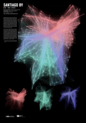
Santiago By (Car, Bus, Metro) is a fine-grained overview of mobility in the city as seen through its mobile phone network. Each thin line represents the path taken by one mobile device. The nodes where the paths seem to converge and stem from are naturally the cell phone towers that receive data from the mobile devices, where data called XDR is produced. XDR is different from GPS data in that we only get the position of the antenna the device is connected to. To transform massive quantities of this data into this, two inferences have to be made: what constitutes a trip and which is its (primary) transport mode.Trips are inferred independently of one another by looking at their subset of antennas. Mode of transport is then inferred using topic-supervised non-negative matrix factorization (TS-NMF) over the whole set of devices and towers. TS-NMF is a semi-supervised algorithm that decomposes matrix into the product of two matrices of a lower rank (or number of dimensions). The number of dimensions is a parameter and the output is the probability of each element (devices and antennas) belonging to each cluster, where each cluster represents a mode of transportation. The resulting clusters match expectations about mobility in the city.
XDR Data was provided by Spanish telco Telefónica for the authors previous published work (cited on the poster) while authors were working on the Data Science Institute, Universidad del Desarrollo (Chile).

