Print Visualizations at Data Stories 2025
Virunga National Park
Author:
Stanislas Mahussi Gandaho
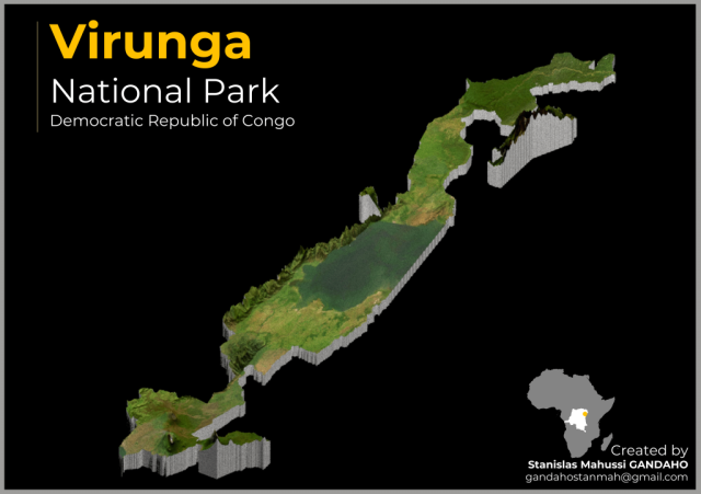
Virunga National Park, situated in the eastern part of the Democratic Republic of the Congo, holds the prestigious title of being a UNESCO World Heritage Site. Established back in 1925, this vast park covers an expansive area of 8,090 square kilometers. It boasts a remarkable biodiversity, with more than 3,000 species of both fauna and flora, including the endangered mountain gorilla. This ecological wonderland's diverse landscapes are significantly influenced by two active volcanoes, Mount Nyiragongo and Nyamuragira. The park's topography exhibits a wide range of elevations, spanning from 680 meters (2,230 feet) in the Semliki River valley to a towering 5,109 meters (16,762 feet) in the Rwenzori Mountains. Within its borders, one can explore a plethora of distinct habitats, encompassing everything from swamps and steppes to the snow-covered peaks of the Rwenzori Mountains, which reach altitudes exceeding 5,000 meters. Additionally, the park features lava plains and savannahs that adorn the slopes of its volcanoes. Virunga National Park attracts numerous tourists, particularly those seeking the thrill of mountain gorilla treks and the challenge of climbing Mount Nyiragongo. This 3D visualization shows some of the park's geographical and topographical features. The visualization was carried out using the R programming language. The data used is ArcGIS satellite imagery.